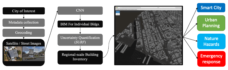
Our tools assist decision-makers by harvesting the information of the built and natural environment, at multiple scales.
The tool is an implementation of a framework that can collect and analyze satellite and street level images.
Using neural networks, we can extract useful information that was never available before.
The extracted information can be used for projects in smart city, urban planning, natural hazard management, emergency response, insurance pricing, etc.
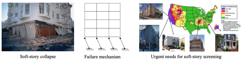
Example: Hunt for seismically vulnerable buildings
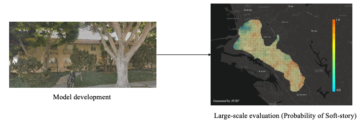
Rapid and accurate identification of potential structural deficiencies is a crucial task in seismic vulnerability evaluation of large building inventories in a region. In case of multi-story structures, abrupt vertical variations of story stiffness are known to significantly increase the likelihood of collapse during a moderate or severe earthquake. Identifying and retrofitting buildings with such irregularities—generally termed as soft-story buildings—is, therefore, vital in earthquake preparedness and loss mitigation efforts. Soft-story building identification through conventional means is a labor-intensive and time-consuming process. In this example, an automated procedure is devised that is based on deep learning techniques that can identify soft-story buildings from street-view images at a regional scale.